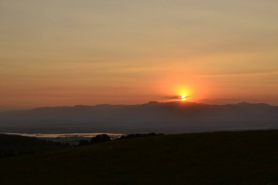
Table Rock
Table Rock
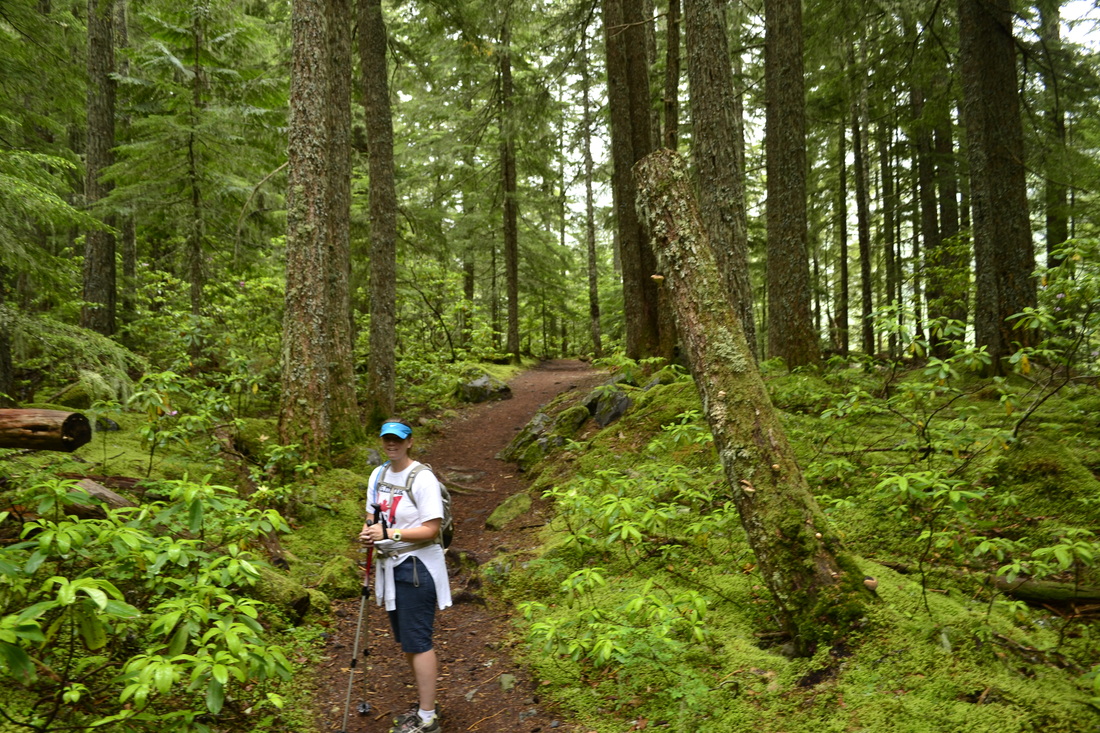
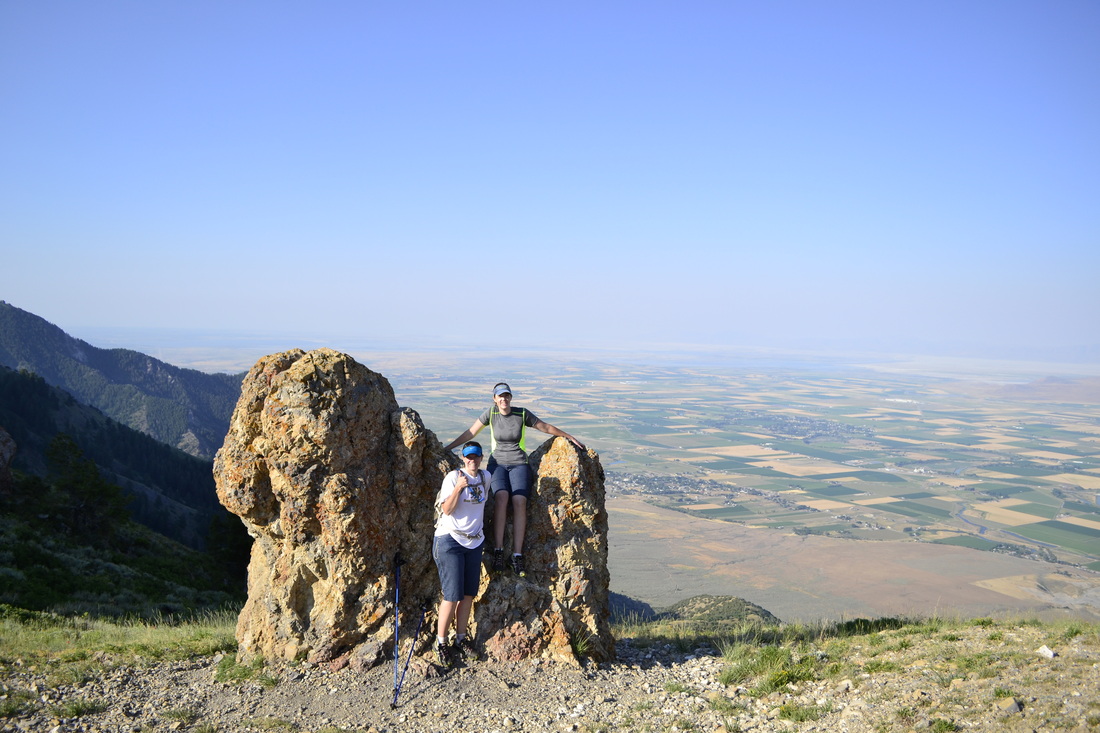
One of the hikes we have done the most is to Table Rock (sometimes called Table Mountain by non-natives). It is pretty tough, but the view at the end is worth it. The hike starts at Teton Canyon Campground. You can also hike to Devil's Staircase, Sunset Lake, Alaska Basin, and Hurricane Pass (and over to Jenny Lake). There are two ways to hike up to Table Rock. The first way is up Huckleberry Canyon. This trail is about 7 miles (one way) to the top and the elevation climb is more gradual. The second way up is the "Face" Trail. This trail starts right behind the bathroom (outhouse). This trail is very steep and is about 4 miles (one way) to the top. Most of the times we have done this hike by climbing up Huckleberry Canyon and coming down the Face Trail (which can be hard on your knees). Since we have hiking poles, the last few times we have gone up and down the Face Trail. Once you get on top of Table Rock, the Tetons are right there. We always eat our lunch on top while enjoying the views. Be prepared for windy and cool conditions on top.
One of the hikes we have done the most is to Table Rock (sometimes called Table Mountain by non-natives). It is pretty tough, but the view at the end is worth it. The hike starts at Teton Canyon Campground. You can also hike to Devil's Staircase, Sunset Lake, Alaska Basin, and Hurricane Pass (and over to Jenny Lake). There are two ways to hike up to Table Rock. The first way is up Huckleberry Canyon. This trail is about 7 miles (one way) to the top and the elevation climb is more gradual. The second way up is the "Face" Trail. This trail starts right behind the bathroom (outhouse). This trail is very steep and is about 4 miles (one way) to the top. Most of the times we have done this hike by climbing up Huckleberry Canyon and coming down the Face Trail (which can be hard on your knees). Since we have hiking poles, the last few times we have gone up and down the Face Trail. Once you get on top of Table Rock, the Tetons are right there. We always eat our lunch on top while enjoying the views. Be prepared for windy and cool conditions on top.
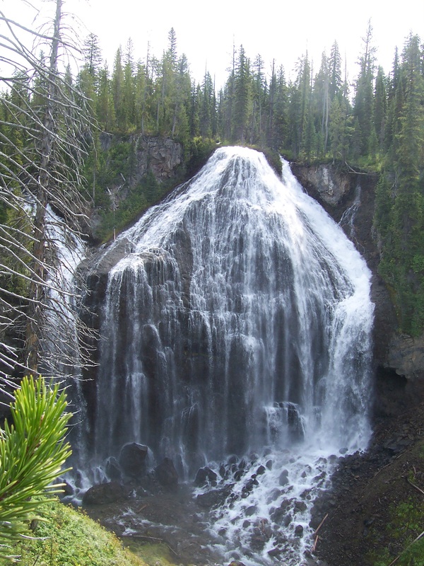
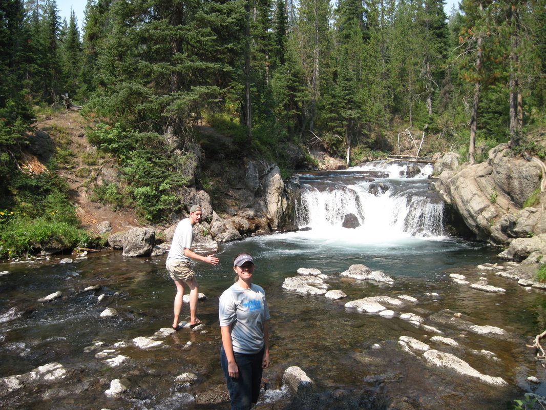
Union Falls
Scout Pool
|
Union Falls
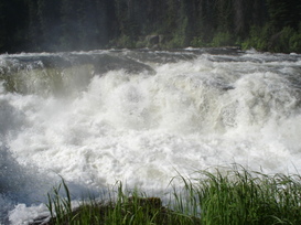
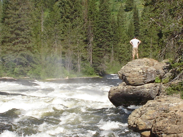
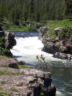
An all-day hike (about 15 miles round trip) that ends with a spectacular waterfall is Union Falls. It is actually located in near the Southern edge of Yellowstone National Park, but not in the main park area. There are a number of different places to start but we have always started at Fish Lake (it is the closest one to Idaho). To get to the trail head, you travel the Reclamation Road (aka Ashton-Flagg Ranch Road), this is a gravel road that requires you to go slowly, if you like your vehicle. (Our first time on this road we rescued a family from Michigan who had two flat tires. You will also want to have a high clearance vehicle. After you have traveled about 11 miles, you need to start looking for Forest Service Rd 048 (which is on the left, if you are coming from Idaho). This is not marked on the Reclamation Rd, so you have to keep an eye out for it. This Rd 048 will take you to Loon Lake (the left fork) or to Fish Lake (take the right fork). Keep to the right and follow the road until it ends. This is where the trail starts. You will have 3 water crossings for this hike. The water is fairly deep and the hike should be done later in the summer. The hike itself is fairly flat if you start at Fish Lake (if you start at Grassy Lake there is a significant hill). After you get your fill of Union Falls, you can go to a warm water pool (called Scout Pool) and swim. |
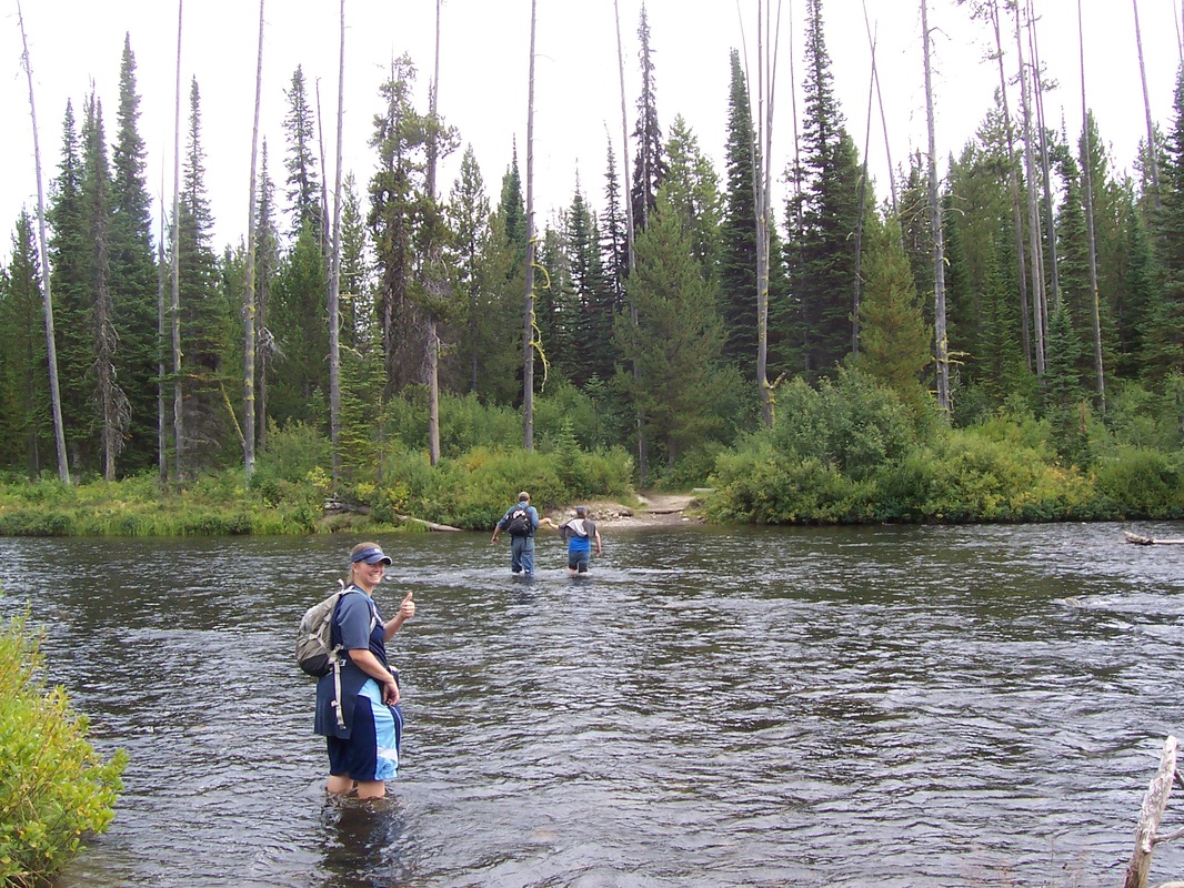
One of the water crossings. Notice the water is to Melinda's knees. This is in late August.
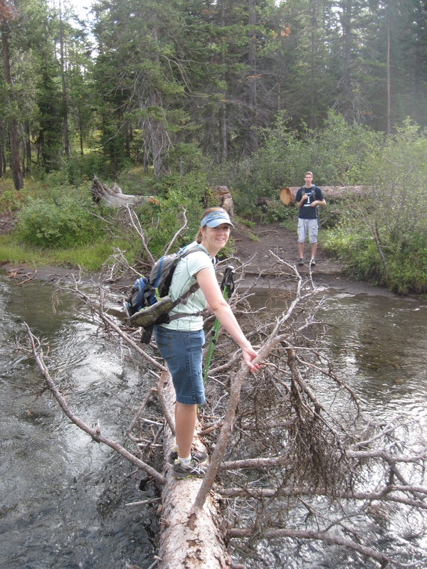
A tree made it so there was one less water crossing.
|
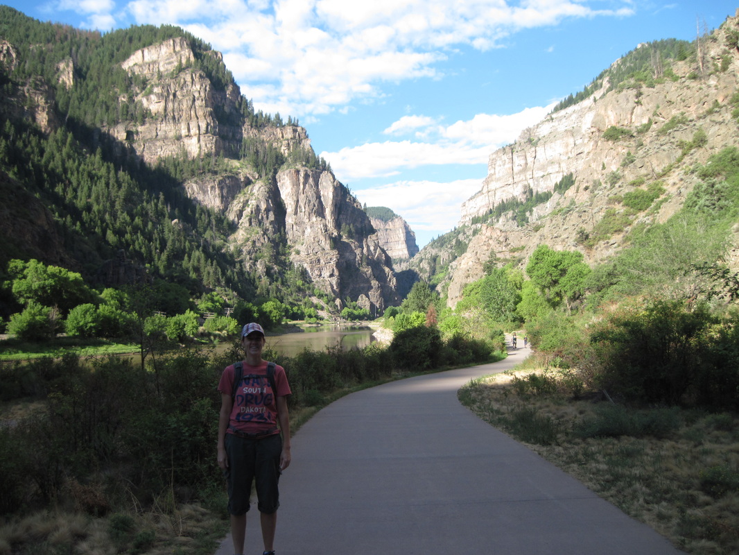
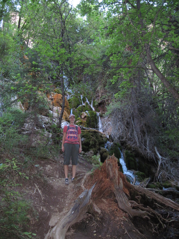
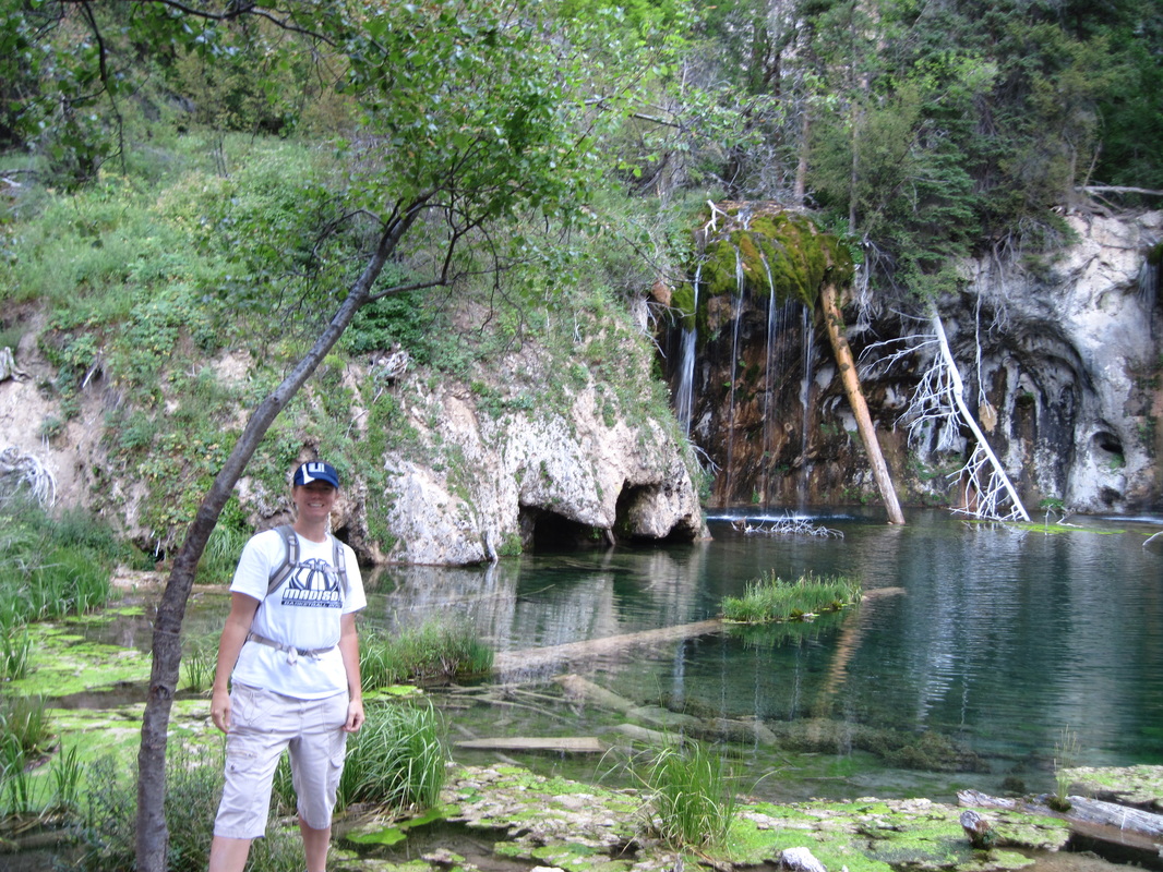
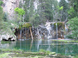 Hanging Lake
Hanging Lake
If you are traveling along I-70 in Colorado, you should consider hiking to Hanging Lake. The hike is 2.4 miles (round trip) and is fairly steep, so don't forget your water. We started hiking early and had the trail to ourselves. The trail head is in Glenwood Canyon about 10 miles outside of Glenwood Springs.
If you are traveling along I-70 in Colorado, you should consider hiking to Hanging Lake. The hike is 2.4 miles (round trip) and is fairly steep, so don't forget your water. We started hiking early and had the trail to ourselves. The trail head is in Glenwood Canyon about 10 miles outside of Glenwood Springs.
|
|
|
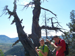 Jared (our brother) and Elisa in front of Old Juniper.
Old Juniper
The hike to Old Juniper is located up Logan Canyon. The hike is about 9 miles (round trip) and leads to a gnarled old juniper tree. We don't know how old it is for sure, but some estimates put it at over 3200 years old. This trail is also a biking trail so watch out for bikers. The hike itself is a little strenuous and if it is too long, Logan Canyon has other trails you can try like the Wind Cave.
The hike to Old Juniper is located up Logan Canyon. The hike is about 9 miles (round trip) and leads to a gnarled old juniper tree. We don't know how old it is for sure, but some estimates put it at over 3200 years old. This trail is also a biking trail so watch out for bikers. The hike itself is a little strenuous and if it is too long, Logan Canyon has other trails you can try like the Wind Cave.
|
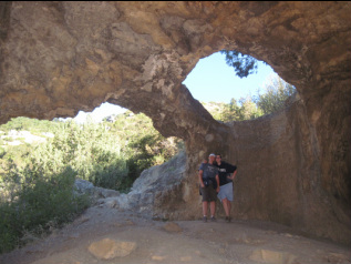
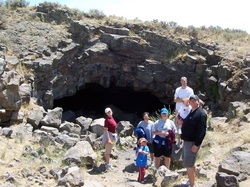
Wind Cave (Logan Canyon)
Another hike in Logan Canyon is the Wind Cave. It is a 3 mile (round trip) hike. The trail head is located off Hwy 89 across from the Guinavah-Malibu Campground. The hike is a little steep but not too difficult. It is a very popular trail and you will most likely see many people while hiking it. |
|
|
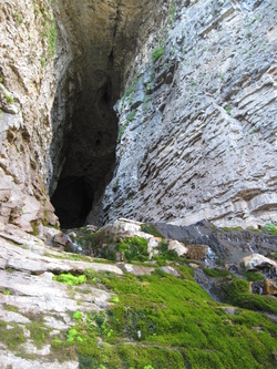
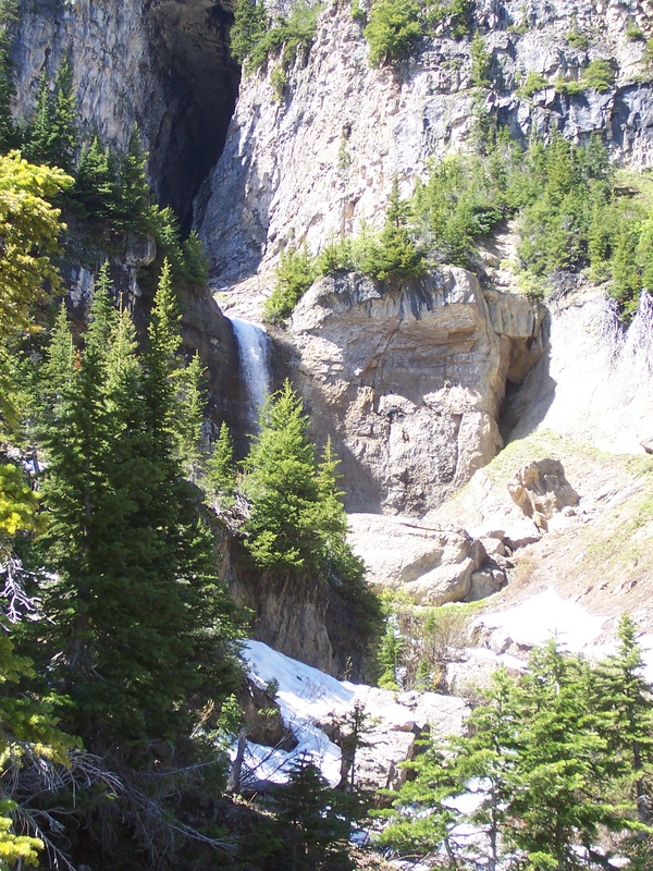
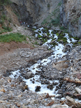
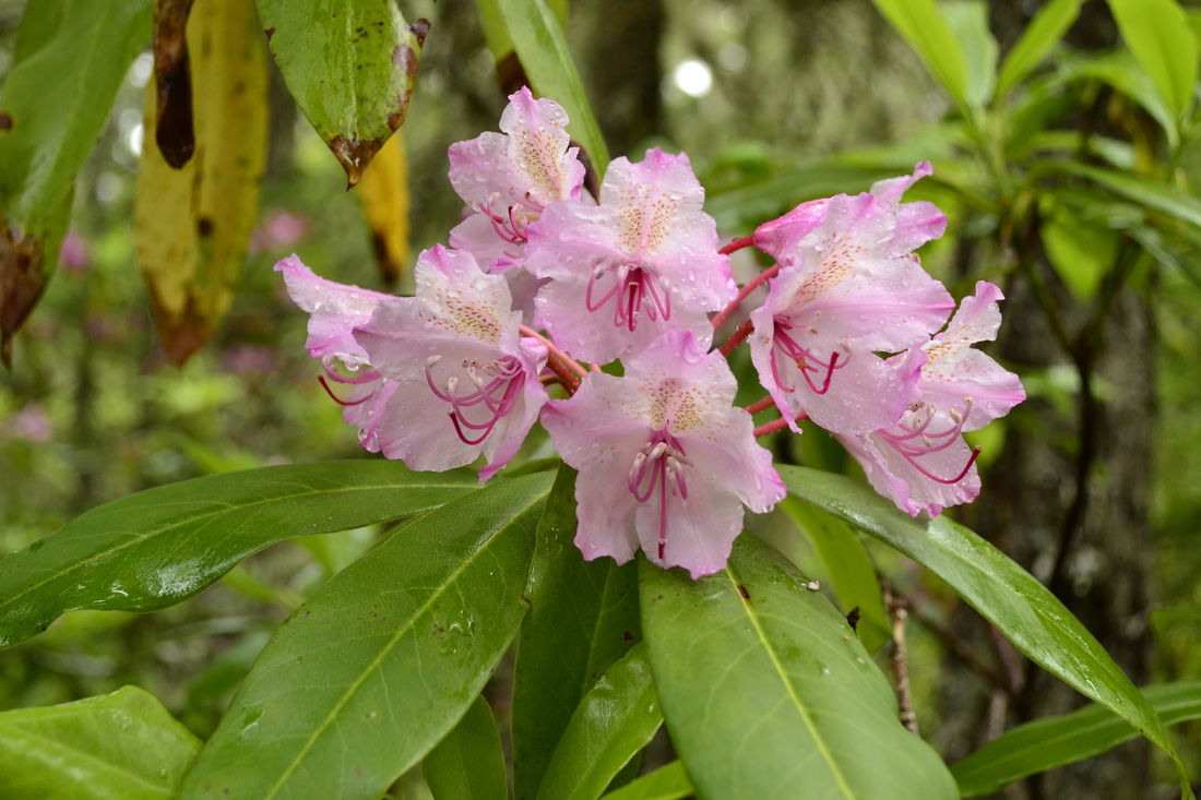
Wind Cave (Darby Canyon)
This 5 mile (round trip) hike is located up Darby Canyon. The road to Darby Canyon is off Hwy 33 between Driggs and Victor, Idaho. The hike is not too difficult and there are many great views to see. When you reach the cave, there can be a lot or a little bit of water coming out. The picture to the far right was in 2009 when we couldn't even get right to the cave because of snow. The picture just right is in 2013 when there was just a little water and we hiked back into the cave a little way (bring flashlights). |
|
|
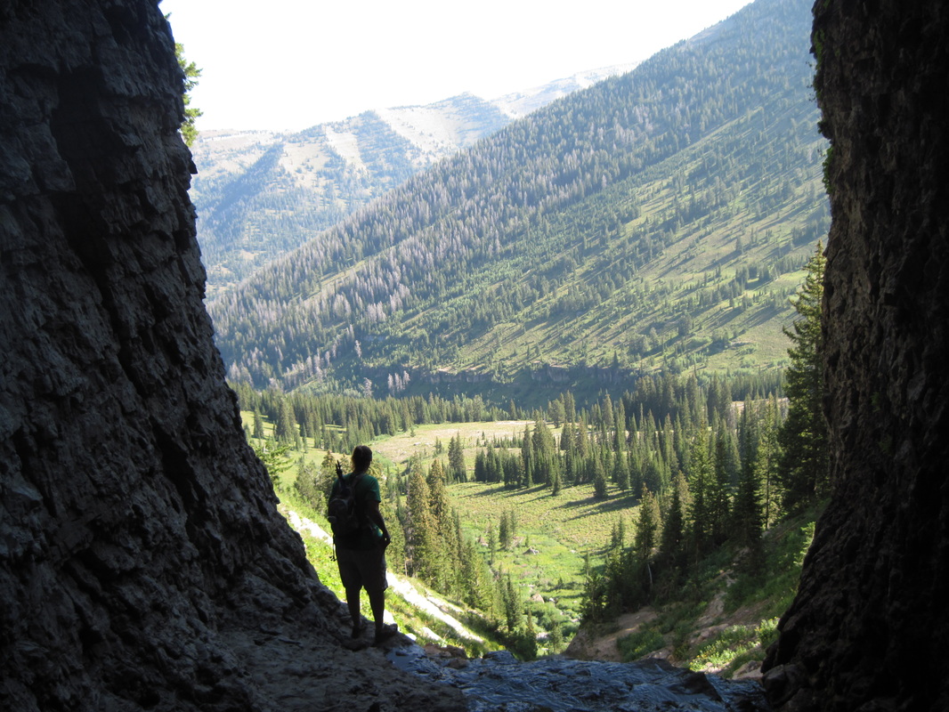
Looking out of the cave
|
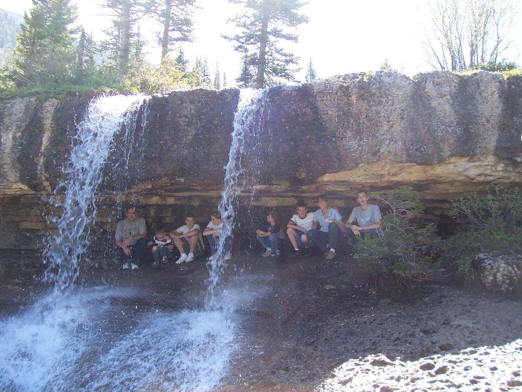
A nice waterfall during a wet year (Megan this picture is for you)
|
Palisades Creek Trail (Lower and Upper Palisades Lakes)
Swan Valley, Idaho is where the Palisades Creek Trail is located. The trail follows the Palisades Creek most of the 4 miles to the Lower Palisades Lake. In high water years, you may have a little flooding along the trail. You can also hike an additional 2.2 miles past the lower lake to reach the Upper Palisades Lake. The scenery for this hike is beautiful and very green. There are some hills, but it is not too difficult. There is a campground near the lower lake as well. The trailhead is located just past Irwin on the left (look for a sign saying Palisades Creek Campground). After the hike, you can stop at the Rainey Creek Country Store for a square ice cream cone. It's a popular spot so be prepared for crowds.
Swan Valley, Idaho is where the Palisades Creek Trail is located. The trail follows the Palisades Creek most of the 4 miles to the Lower Palisades Lake. In high water years, you may have a little flooding along the trail. You can also hike an additional 2.2 miles past the lower lake to reach the Upper Palisades Lake. The scenery for this hike is beautiful and very green. There are some hills, but it is not too difficult. There is a campground near the lower lake as well. The trailhead is located just past Irwin on the left (look for a sign saying Palisades Creek Campground). After the hike, you can stop at the Rainey Creek Country Store for a square ice cream cone. It's a popular spot so be prepared for crowds.
|
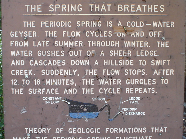
Intermittent Spring
Located in Afton, Wyoming, is a short hike to an interesting phenomenon called the Intermittent Spring. Like the sign to the right says, the spring will suddenly stop flowing and then start again. Unfortunately, when we went it had been a very wet year and the flow did not stop. The hike to the springs is about a mile and is relatively flat. You do have to hike up at the end to get to where the water flows out of the hill. |
|
|
Sheep Falls (by Cave Falls)
There are 2 different Sheep Falls that we have hiked to. This one is located on the Falls River and is near Yellowstone National Park. You can actually drive most of the way to the falls if you have a good vehicle, but we usually hike the last 2 miles to the falls. To get to the trailhead, you drive on the road to Cave Falls just outside of Ashton, Idaho. After about 15 miles, you turn on Wyoming Creek Road #124. This is a little rougher road and you continue on for 2.4 miles to an unmarked jeep trail on the left. This is where we start hiking. The year we did this hike, there were a TON of mosquitoes--especially at the beginning. I am talking about clouds of them. Bring repellent and be prepared to reapply. |
|
|
Sheep Falls (by Island Park)
There is another Sheep Falls that is also a nice hike. The trail is a one-mile hike to the falls. It is not a difficult hike and you get a nice view. To find the trail head, you drive 9.2 miles north of Ashton, Idaho and turn right onto Sheep Falls Road #163. If you reach the turn off for Harriman State Park, you have gone to far. You will notice as you head south toward Ashton, there will be a sign for Sheep Falls. Once you are on the Sheep Falls Road #163, drive about 2.3 miles to the trailhead for Sheep Falls Trail. It is a hike that kids could easily do as well.
There is another Sheep Falls that is also a nice hike. The trail is a one-mile hike to the falls. It is not a difficult hike and you get a nice view. To find the trail head, you drive 9.2 miles north of Ashton, Idaho and turn right onto Sheep Falls Road #163. If you reach the turn off for Harriman State Park, you have gone to far. You will notice as you head south toward Ashton, there will be a sign for Sheep Falls. Once you are on the Sheep Falls Road #163, drive about 2.3 miles to the trailhead for Sheep Falls Trail. It is a hike that kids could easily do as well.
Civil Defense Cave
Another fun hike/adventure is the Civil Defense Cave. It is a great place to go on a hot day because the cave is very cool. It takes about 45 minutes to an hour to get back to the entrance. Make sure you bring flashlights and a jacket as well, since it is cool inside the cave.
Directions: From Rexburg, go North on the Salem Highway about 16.5 miles. Drive past the sand dunes then on the right side of the road there will be a yellow cairn (pile of rocks) indicating the turn off. It's about five miles to the caves from the turn off. On the dirt road you will come to a fork in the road. Make sure you stay left.
GPS Coordinates:
Latitude: 44.158549
Longitude: -111.779082
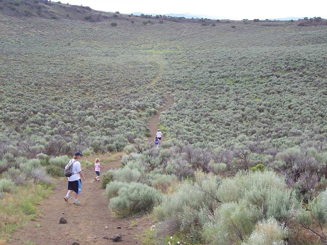
Menan Butte (aka "R" Mountain)
Another nice hike is to "R" Mountain, which is just outside of Rexburg. The hike is 3.5 miles if you go around the entire caldera. It is definitely a hike to do when it is cooler since there is very little (almost no) shade on the hike. If you do hike when it is hot, be sure to bring plenty of water. You can also hike through the caldera as well, which is fun too. The hike is steep at the beginning (about .7 of a mile to get to the top from the trailhead). It is not extremely difficult and we have hiked it with a number of younger kids. Just head West on Hwy 33 toward the butte with the "R" on it. You drive on Hwy 33 until you see a sign for the landfill and will turn left. You can continue on that road past the turn for the landfill and take the first right. Follow the road until you come to a paved parking lot on the left which is the trailhead.
Another nice hike is to "R" Mountain, which is just outside of Rexburg. The hike is 3.5 miles if you go around the entire caldera. It is definitely a hike to do when it is cooler since there is very little (almost no) shade on the hike. If you do hike when it is hot, be sure to bring plenty of water. You can also hike through the caldera as well, which is fun too. The hike is steep at the beginning (about .7 of a mile to get to the top from the trailhead). It is not extremely difficult and we have hiked it with a number of younger kids. Just head West on Hwy 33 toward the butte with the "R" on it. You drive on Hwy 33 until you see a sign for the landfill and will turn left. You can continue on that road past the turn for the landfill and take the first right. Follow the road until you come to a paved parking lot on the left which is the trailhead.
Hiking through the caldera
|
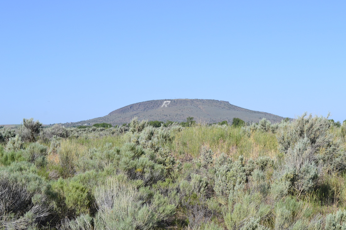
R Mountain from a distance
|
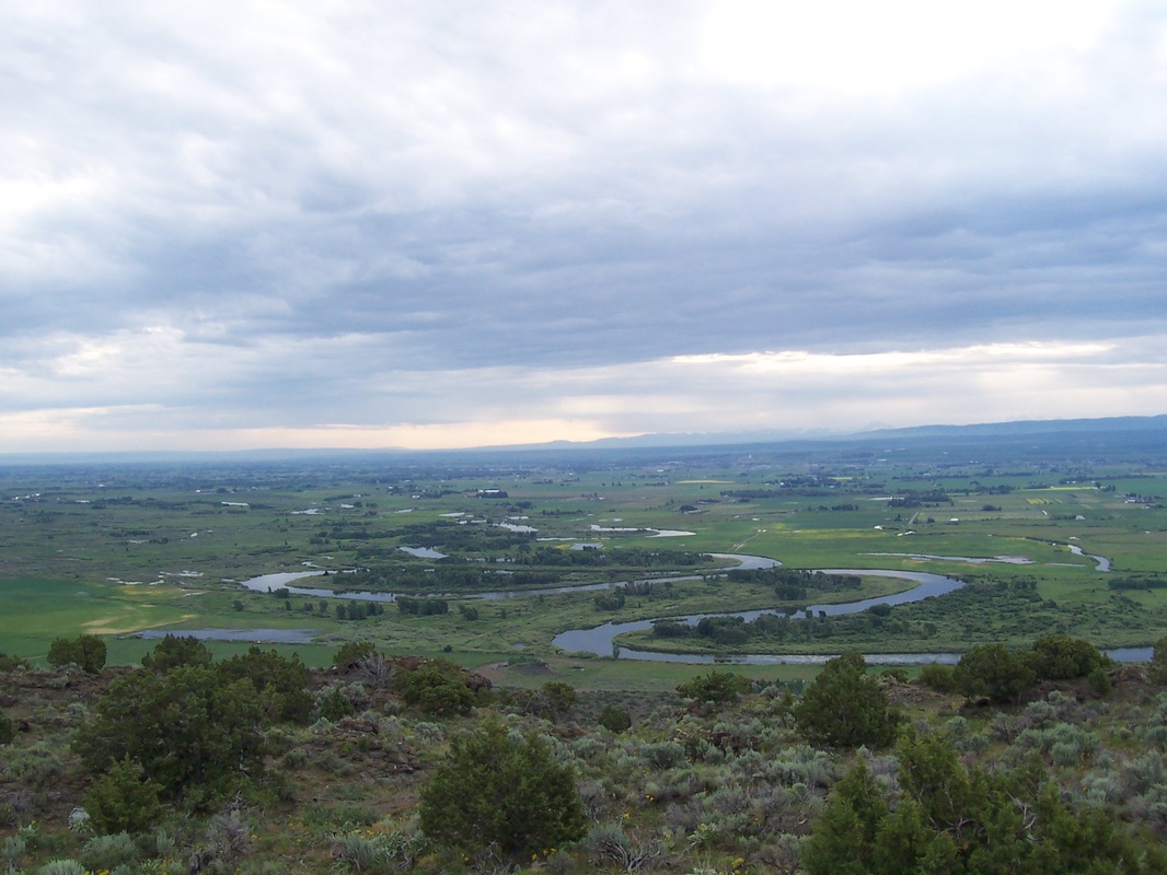
View from R Mountain
|
|
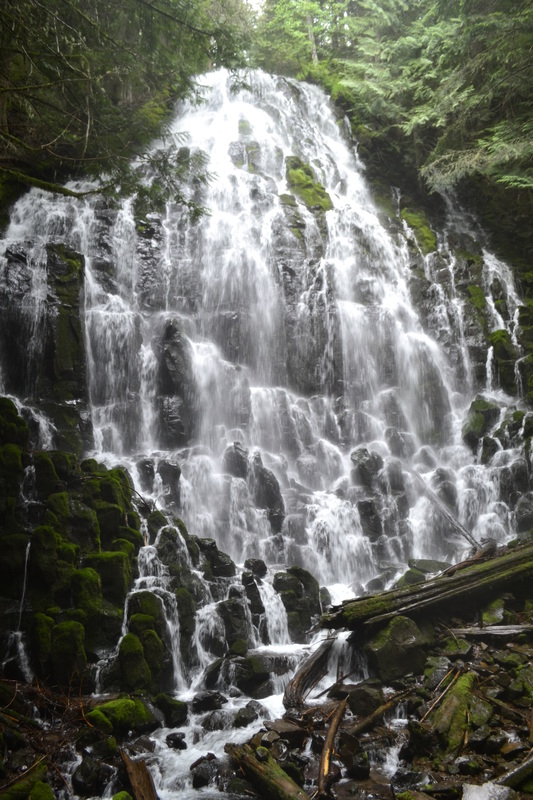
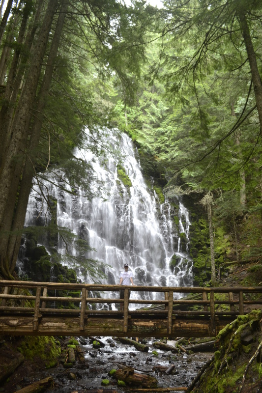
Ramona Falls
Ramona Falls is a beautiful waterfall located in the Mt Hood Wilderness. The trail head is located near the community of Zigzag on Hwy 26. You turn north on Lolo Pass Road and follow the signs to Ramona Falls. The roads are paved to the trail head, but are narrow in some spots. A $5 fee is required and can be picked up at the ranger station in Zigzag. It is right by where you turn on Lolo Pass Road. If you have an Interagency Annual Pass (costs $80), which also gets you into all of the national parks, you can just display it in your window at the trail head. Oregon also has annual passes for their state parks you could purchase. The hike does not have too much of an elevation gain which makes it very popular. We saw very few people when we did the hike (but then, we were there pretty early on a weekday). As you start the hike, you will come to a registration box where you must fill out a permit. The beginning of the hike follows the creek to a bridge that is brought in each May and removed in October. The hike is about 7 miles round trip and when you get to the waterfall it is definitely all worth it. There are many signs along the way and other hikes leading off the trail that you could take as well. If you are in the Portland area, Ramona Falls is a waterfall you should take the time to see. |
|

|
Triple Falls
After you take in Multnomah Falls in all its awesomeness, you should spend some time in the area seeing some of the other waterfalls. One of the hikes we chose was through the Oneonta Gorge to Triple Falls. Starting at the Oneonta Trailhead just down the road from Multnomah Falls on the Columbia River Scenic Highway (easily accessed from I-84 by Troutdale), the trail is a fairly steep climb. It is about 3 miles round-trip if you go just to the falls and back. There are several trails to other falls and overlooks branching off of the main trail which would lengthen your hike. We chose to go just to Triple Falls and back the way we came. There is a great overlook point and then you can hike over to the top of the falls as well. Just like all hikes seem to be in Oregon, everything was amazingly green and it was a beautiful hike. |
|
HIkes in Grand Teton National Park
|
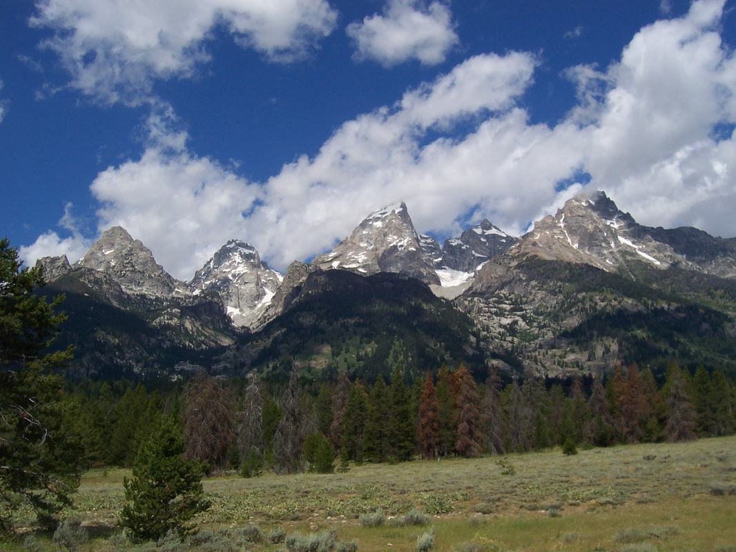
Jenny Lake
The Jenny Lake area of Grand Teton National Park has many hikes for all ages. The best part is that there is a boat to take you across Jenny Lake if you do not want to hike around the lake. The most popular way to hike Jenny Lake is around the south side of the lake. It is about 2.5 miles one way to get to the boat dock from the Jenny Lake Visitor Center. The trail is relatively flat and follows the edge of the lake. Once you are on the other side of the lake, you can hike to Hidden Falls. It is only 2.5 miles one way on the Jenny Lake Trail or if you want to hike to the falls, you can take the boat. It is 1 mile round trip from the boat dock to Hidden Falls. You can also head to Inspiration Point which is 2.9 miles one way from the Jenny Lake Visitor Center or if you take the boat it is 1.8 miles round trip to Inspiration Point from the boat dock. If you want to experience the entire lake, you can hike the Jenny Lake Loop which is 7 miles to go around the entire lake. |
|
|
|
Taggart Lake
The Taggart Lake area is another great one for people of all hiking abilities. Taggart Lake is 3.2 miles round trip from the parking lot. There is a trail that loops back to the parking lot that adds a little more distance (4.0 miles round trip). The hike is level and not too difficult. There is also a trail that leads to Bradley Lake that you can do as well as Taggart Lake which is 4.8 miles round trip. |
|
Lupine Meadows Trail head
Surprise Lake is one of the hikes you can do from this trail head. The distance to the lake is 9.2 miles round trip. You can extend the hike to 9.6 miles to also see Amphitheater Lake. It is a difficult hike and you hike about 3,000 feet in elevation. As you can see, there is snow as well and this is a hike that you may want to wait until later in the summer to attempt. Lupine Meadows is also where those who are hiking the Grand start at and head to Garnet Canyon. You can also detour and hike to Bradley and Taggart Lake if you would like to (or you can just enjoy the view of them from the trail). |
|
|
Mt. Washburn
This is a great hike to do if you are visiting Yellowstone National Park. The hike is about 7 miles round trip from the Dunraven Pass Trailhead, which is located between the Canyon and Tower Junctions in Yellowstone. If you are going in the summer, get there early because the parking lot fills fast. You can also hike from the Chittenden Road Trailhead, which is only about 5 miles round trip, but you do not get the same views. You can also bike up the Chittenden Road Trailhead instead. The trail is very wide and you can hike 4 or 5 across easily. It can get very windy and cold on top at the lookout so bring a jacket and make sure your hat is secure. You will never be disappointed with the views and you may even get to walk through a herd of big horn sheep. |
|
|
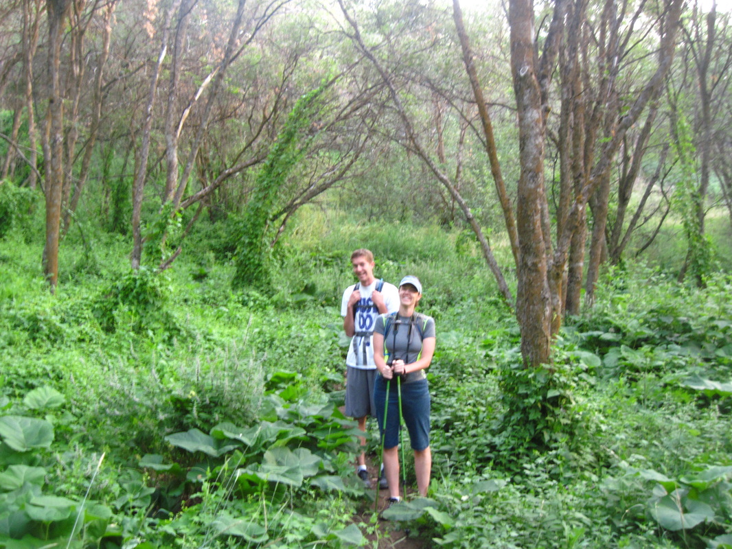
The Wellsvilles
The Wellsvilles is a challenging hike west of Logan, Utah. The hike is 6 miles round trip and has a lot of uphill. There are three different places you can start the hike. We hiked from the Deep Canyon Trailhead. You can also hike from the Coldwater East Trailhead or the Rattlesnake Trailhead. Once you get on the top of the Wellsvilles, you can hike an extra 2 miles to reach Stewart Pass and a mile pass that is the Wellsville Cone. The trail has a lot of tall foliage and many times you cannot see the trail. The view when you get to the top is definitely worth it. |
Melinda and Elisa with Honeyville in the distance.
|
Sunrise before the hike.
Elisa and Tyler (our nephew) on the trail.
|
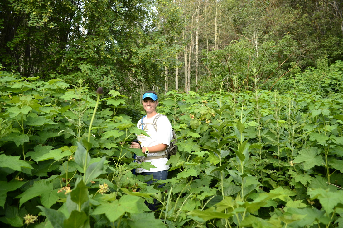
This is how tall the foliage was throughout much of the hike.
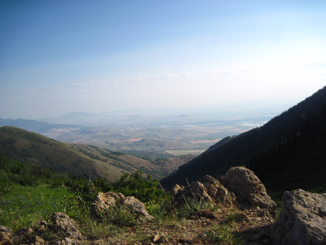
View back toward Logan from the Wellsvilles.
|
|
|
Crimson Trail, Logan, Utah
The Crimson Trail is another great hike to do in Logan Canyon. There are two different places you can start the hike. You can either start at Spring Hollow Campground or at the Guinavah-Malibu Campground. We started the Spring Hollow Campground and came back on the Riverside Trail. The hike was 4.1 miles round trip. The beginning of the trail is pretty challenging as you hike up to the ridge. (It does get hot in the afternoon.) Once you reach the ridge, the views are amazing and the trail levels out for a bit. You can see the Wind Cave across the canyon as well as other great views. Some parts of the trail put you pretty close to the edge so watch your step. We saw a baby rattlesnake when we hiked it as well, so you need to watch out for other dangers as well. It is definitely a fun hike to do if you are ever in Cache Valley. |
|
Kanarraville Falls
Kanarraville, Utah In 2015, we went to Southern Utah in October to do some hiking. We found some information on this hike and decided to check it out. There were thunderstorms predicted every afternoon so we did it early in the morning. We had the trail to ourselves on the way in and passed a couple of groups coming out. The hike is about 5 miles round trip, but definitely worth it. It costs $10 to park in the lot closest to the hike. However, you could park in Kanarraville (which is about 30 miles from St. George, Utah) and add about a mile to your hike. The hiking is pretty flat and you follow the creek for most of it. Kids could easily do the hike. Plan on bringing shoes that will get wet because once you enter the slot canyon at the end of the hike, you are in water. Because it is a slot canyon, pay attention to the weather and flash flood warnings so you don't get hurt. |
|
Len Foote Hike Inn
Dawsonville, Georgia
In 2016, we went on a cross country road trip. Our trip was planned around going to the Len Foote Hike Inn. We had read about the hike a few years earlier and really wanted to do it. It starts in Amicalola Falls State Park (which also has an amazing waterfall). It takes about 5 miles to get to the Inn. Many people stop at the inn on their way to the Appalachian Trail. The hike in is not too difficult. There are a few places where there is a bit of an incline, but nothing much. We struggled with the heat and humidity the most. We are used to starting hikes in the morning and it is 40 degrees. We started closer to noon and it was around 70 to 80 degrees with a lot of humidity. The trail is well marked is so green. The rooms at the inn have bunk beds. There is a bath house that has showers and toilets. It was wonderful to take a shower after arriving the at the inn. They provide you with dinner and breakfast (we stayed only one night). The dinner was fantastic. You can take a tour of the inn and they show you how they are focused on conservation. They recycle the water and have composting toilets. Solar panels are also used. You are asked to not bring cell phones and other electronics. We did not want to leave ours in our car so we had ours, but did not use them. There was a family there whose kids were using their phones most of the time. There is a room with books and games, plus it is fun to talk to the people staying at the inn.
